GRACO: Gravitational and Contouritic Interactions on the Upper Slope of the Gulf of Cadiz close to the Straits of Gibraltar.
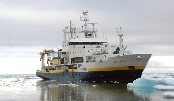
| Project Acronym &Title: GRACO – Gravitational and Contouritic Interactions on the Upper Slope of the Gulf of Cadiz close to the Straits of Gibraltar Area: Gulf of Cadiz Research Vessel: L’Atalante, Ifremer (France) Chief scientist: Marga García, Andalusian Institute of Earth Sciences (CSIC-UGR) Co-chief scientist: Gemma Ercilla, Institute of Marine Sciences (CSIC) Other project partners: Spanish Geological Survey (IGME) (Spain); Spanish Institute of Oceanography (IEO) (Spain); Universities: Royal Holloway University of London (UK), Vigo (Spain), Cadiz (Spain), Lisbon (Portugal), Gent (Belgium), Heriot-Watt (UK), Cardiff (UK), Tangier (Marocco), P.-M. Curie (France) and Sapienza (Italy); IPMA-EMEPEC (Portugal); CIRCE (France). Date: 22 September – 1 October 2016 |
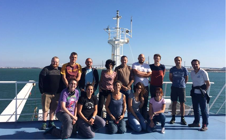   |
| Marga García, Andalusian Institute of Earth Sciences (CSIC-UGR), Spain “My participation in the GRACO cruise has given me the first experience as Chief Scientist and as the coordinator of an amazing group of scientist. I’ve had the support from the Eurofleets2 Program from the first workshop held in Tallin (Estonia) in February 2014 on how to write successful proposals to the last stage of completing the cruise. This has been the first time for many of us to work with equipment and facilities that were not available for us before. The study of the data acquired during the GRACO cruise will be a challenge that will involve the collaboration of the large number of participants of the project. This will benefit the exploitation of the results and will promote a long-term cooperative network that we hope will last in the future.” |
 |
Main Objectives
|
The project is focused on the study of an up-to-know little known part of the Gulf of Cadiz. The region is defined as a huge Contourite System, dominated by the effect of the Mediterranean Outflow Water (a contour current). The main objective of this project is the study of gravitational features (escarpments and valleys) on the shelf-edge and upper slope of the Cadiz margin of the Gulf of Cadiz, to determine the temporal and spatial inter-relationship between gravitational (downslope) and contouritic (alongslope, related to the flow of deep water currents) sedimentary processes and their paleoceanographic and sedimentary implications. The main hypothesis to be tested is the actual link of the morphological features with the dominance along time of gravitational and oceanographic processes. We pretend to answer some specific scientific questions: 1) Which are the major morphosedimentary processes shaping the Cadiz margin shelf-edge and upper slope region on a Pliocene- Pleistocene scale? Are gravitational features active today? 2) How can we infer the interaction between gravitational and contouritic processes based on the sedimentary facies, associated structures and cyclicity patterns? 3) How is the Mediterranean Outflow Water (MOW) flow pattern affecting the morphology? Are gravitational features related to the MOW onset and evolution, and how? 4) Which are the main morphosedimentary processes and their controlling factors and how do they interact? Do new interpretations fit within previously published sedimentary models? 5) Have downslope and alongslope processes predominated along successive stages of the evolution of the Cadiz margin, as on the Algarve margin? Can a regional correlation be done in order to generate a complete model of the evolution of the Gulf of Cadiz Contourite Depositional System? |
Work progress and main achievements
|
Being the cruise very recent, and having being based on sediment sampling, most of the acquired data have still to be processed. Nevertheless, onboard preliminary analysis allows some preliminary interpretations. Different types of data were acquired:
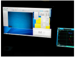
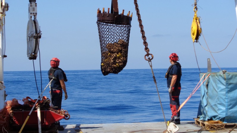
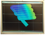
2) A total of 42 sediment samples were taken in sites selected based on information from available seismic profiles from the study area, which determined the type of equipment to be used: Rock dredge, Kullenberg piston corer and Box corer. – Rock dredge samples (6; Figure 2) were obtained from morphological highs and consisted on breccia, sandstone with laminations, marl clast, conglomerate and a variety of coral fragments. 3) A mosaic of high-resolution (grid of 15 m; (Fig. 3) was obtained in the dune fields of the proximal Cadiz Contourite Channel. Two multibeam echosounders (SIMRAD EM710 and EM122) were used simultaneously. The data were processed on board. 4) The SIMRAD EK60 Single Beam echo sounder was used during the duration of the cruise to record profiles of the water column and seafloor, with the aim of characterizing water masses and the interfaces between them. 5) The two acoustic Doppler current profilers (ADCP) installed on the hull of the R/V L’Atalante where used during the GRACO cruise. The obtained dataset allows interpreting the character and behavior of the main water masses in the study area, but velocity data require further processing from raw data to incorporate heading, pitch and roll from vessel navigation system |
   |